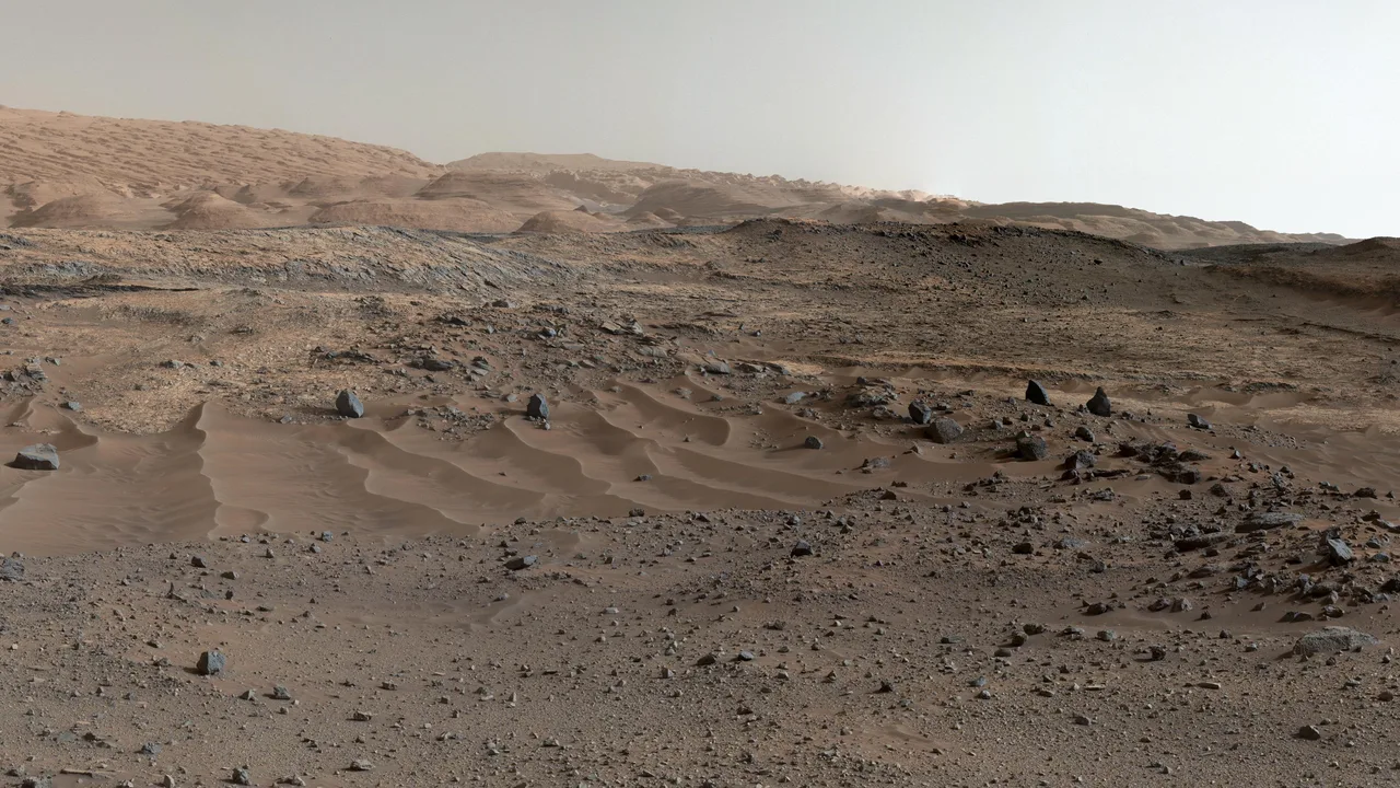
NASA’s Curiosity rover continues its climb up Mount Sharp on Mars, sending back panoramas that reveal wind-carved cliffs and ancient rock layers. In this explainer, the mission team walks through what the latest images show and why they matter.
Video credit: NASA/JPL-Caltech.
There is a Canadian instrument riding in these photographs’ margins. Curiosity’s Alpha Particle X-Ray Spectrometer — the device that determines the chemistry of Martian rock and soil — was supplied by the Canadian Space Agency, built by MDA and led by University of Guelph scientist Ralf Gellert. Every composition reading the rover has taken since 2012 has passed through Canadian hardware, a contribution Ottawa cites whenever it argues that a middle power can hold a permanent seat in exploration’s first rank.
The panoramas themselves are the mission’s public ledger. Thirteen years of climbing Mount Sharp have converted a two-year rover into infrastructure, and Canadian science teams remain on the roster for its remaining years — a return, on a few million dollars of instrument, that the country’s much larger Artemis commitments are now expected to repeat.
A panorama from Curiosity is not a single photograph. The rover’s mast-mounted cameras build a wide view from many individual frames, each exposed and focused in sequence while the mast pans across the scene. Those frames are transmitted to Earth as data, then calibrated and stitched into a mosaic by imaging teams who correct for lighting, lens effects and the colour response of the cameras. Calibration targets carried on the rover give the team a known reference under Martian light, which helps keep colours and brightness consistent from one mosaic to the next. The result looks seamless, but every seam marks a separate pointing of the mast, a separate downlink and a separate check before the pieces are joined.
That care matters because the panorama is a working document, not only a picture. Geologists read it at several scales at once: the shape of the terrain ahead for safe driving, the texture of nearby outcrops for choosing closer targets, and the broader layering of Mount Sharp for reconstructing how Gale Crater changed over time. Mount Sharp’s strata were laid down as sediments and later exposed by erosion, so moving upward through the layers is, in broad terms, moving through different environmental chapters. Lower reaches associated with clays point to sustained interaction with water, while higher sulfate-bearing layers record a drier set of conditions. A panorama lets the team place a single outcrop inside that larger sequence before deciding whether to drive closer, brush or drill.
Images alone do not settle the science. A view of banded rock gains meaning when paired with chemistry and mineralogy gathered at arm’s length, which is where instruments such as the Canadian-supplied Alpha Particle X-Ray Spectrometer come in. Photographs provide context — where a sample sits, how it weathers, what lies beside it — while composition readings test whether the visual impression matches the elements actually present. Weather data, radiation measurements and engineering images complete the picture of a rover that must survive the environment it studies. Each panorama therefore extends two records at once: a geological archive of an ancient crater lake and its drying, and an operational archive of where the rover has been and what it can safely attempt next.
The same habit of reading alien terrain for both evidence and shelter is now shaping lunar exploration. Subsurface voids, if confirmed and mapped, could shield future crews from radiation and temperature swings while preserving a geological record untouched at the surface, much as protected layers on Mars preserve clues that exposed rock has lost. Readers interested in that parallel may enjoy reporting on a Moon cave big enough for a base that may hide in the Sea of Tranquility, where orbital data are being used to infer spaces no camera has yet entered. Mars and the Moon pose different problems, but the method rhymes: assemble partial views into a coherent landscape, test what the eye suggests against instrument data, and let the terrain itself narrow the next move. For a mission in its second decade, that discipline — panorama by panorama, layer by layer — is what turns a long drive up a Martian mountain into a readable history of a planet.
Related reading: Watch: WHO Explains Healthy Ageing in a Changing World · Watch: The 2026 Nobel Peace Prize Announcement